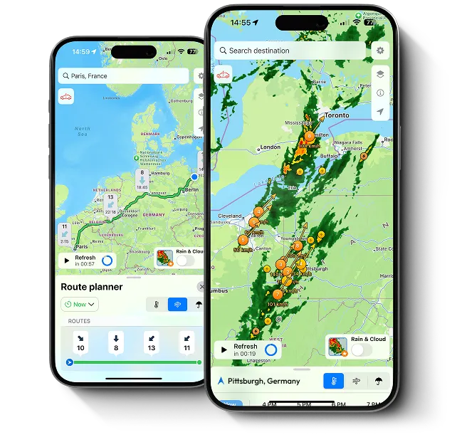
Weather Route Planner
Plan your drive with the power of live weather and road data. Get route suggestions based on forecasted weather, road conditions, radar, and real-time weather alerts. Avoid hazards before you even start the engine.
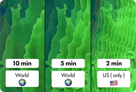
Radar Refresh Every 5 Min Worldwide (2 Min the US)
Stay updated faster than the storm. Radar updates every 5 minutes globally – and every 2 minutes in the US for Premium users. Get the freshest data possible, wherever you are.
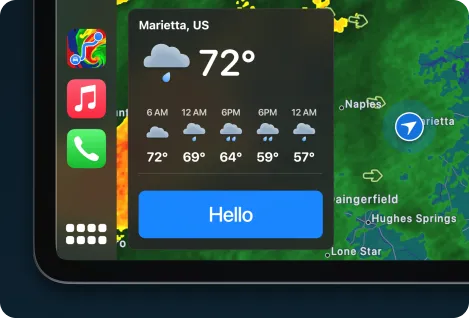
Hello Weather – Welcome Forecast
Your personal weather assistant – every time you start your car. Get an instant, friendly forecast update with all-day insights tailored to your location – from the moment you start your drive.
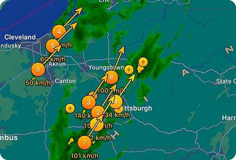
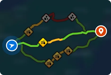
Custom Radar Layers with Storm Cells Tracking
Customize your radar and track severe storms in real time. Choose layers like temperature, wind, or precipitation, and overlay storm cells to see hail, tornadoes, and rotation with speed and direction – all on your car display.